Difference between revisions of "File:Arad political.jpg"
Jump to navigation
Jump to search
(Map of Arad with political boundaries and coloration.) |
m |
||
| Line 1: | Line 1: | ||
Map of Arad with political boundaries and coloration. | Map of Arad with political boundaries and coloration. | ||
| + | [[Category:Maps]] | ||
Latest revision as of 16:42, 6 August 2014
Map of Arad with political boundaries and coloration.
File history
Click on a date/time to view the file as it appeared at that time.
| Date/Time | Thumbnail | Dimensions | User | Comment | |
|---|---|---|---|---|---|
| current | 14:43, 18 May 2014 | 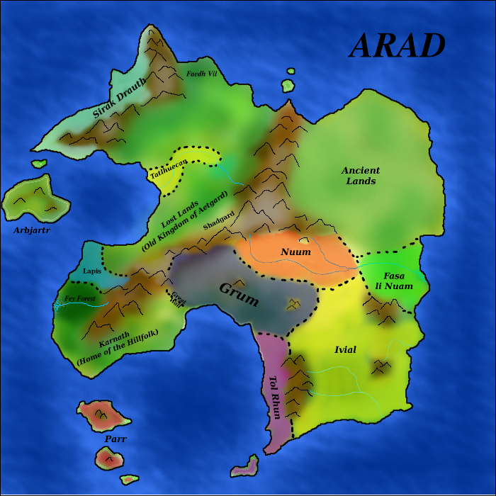 | 700 × 700 (580 KB) | Rias (talk | contribs) | Map of Arad with political boundaries and coloration. |
File usage
The following page uses this file: